
Trails
Trails offer families a healthy and inexpensive activity to enjoy nature, while spending quality time together.
Anderson Trail: .60 miles (currently)
- Newly renovated Jeff Anderson Memorial Trail, at the end of West Main St. and Sandy Beach.
A City trail at Sandy Beach, accessible at the end of Main Street West or Front Street, which dead ends at Sandy Beach. This newly renovated 10' wide packed solid base trail skirts the lake shoreline, with some beautiful view of the lake. This trail is multi-use, but no motorized vehicles are allowed. The plan is to make the trail a loop.
Bridal Veil Falls: .6 miles (round trip)
- Located on the south side of Heber Springs, 49 Bridal Veil Falls Rd (off of Hwy 25 south). Parking at trailhead and picnic tables are available, with an overlook. The trail features the notorious Bridal Veil Falls and accessibility to the bottom requires various skill levels. The trail is primarily used for hiking and is accessible year round. During the rainy season another falls appears northwest of the creek named Cornelius.
- Click here for a map of the Bridal Veil Falls trail
Collins Creek Trail: 1.2 miles
- Located at Hatchery Road. Trail lightly trafficked out and back features a river and is good for all skill levels. The trail is primarily used for hiking and walking.
- Click here for a map of the Collins Creek Trail
Douglas Trail: .50 miles
- Off Bittle Road West, next to the fair grounds on the north side of the road. Easy trail with chat surface and one bridge.
Garlinghouse Trail: .50 miles
- Off Bittle Road West, near the fair grounds. This trail is across the road from Barnett/ Douglas Trail Section. An easy trail with chat surface & one bridge. Lots of wildlife and birds.
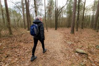
Josh Park Memorial Trail: 1.3 mile loop
- Located at Heber Springs Road N. Trail features a great forest setting and is good for all skill levels. The trail offers a number of activity options and is accessible year-round. Dogs are also able to use this trail, but must be kept on leash.
- Click here for a map of the Josh Park Memorial Trail
Mossy Bluff National Nature Trail:
- Located at 700 Heber Springs Rd N, Heber Springs, AR 72543. This trail is a short nature trail for walking & biking along a wooded bluff, with a scenic view of dam and river.
- Click here for a map of the Mossy Bluff Trail
Sugarloaf Mountain: 1.6 miles (to the summit)
- The view from the mountain extends for miles in every direction, making it a popular destination throughout the years. Natural stone and bluff formations along the way; a series of wooden stairs are at the Southern end; several places allow for viewing along the trail; an easy walking trail skirts the perimeter.
- Click here for a map of the Sugarloaf Mtn trails
Sulphur Creek Trail: .5 miles
- Located at Sulphur Creek. The Sulphur Creek Trail offers a pleasant, tree-lined route in the central Arkansas community of Heber Springs, just a few blocks south of Main Street. Although only a half-mile long, the paved trail is the first completed portion of a larger trail network of about nine miles planned for the city.
- Click here for a map to Sulphur Creek Trail
- Click here for a map of the proposed Sulphur Creek Trail Master Plan